

With 45 miles of shoreline, Lake Hopatcong offers plenty to explore. Whether you're a novice or an experienced paddler, each Lake Hopatcong Water Trail provides mileage details, access points, a printable route map, and a Google Map for easy navigation.
 |
|
||
| Distance: 3.34 Miles |
PDF Route Map Coming Soon! |
Google Map | OuterSpatial |
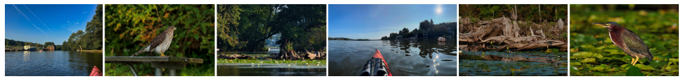
 TRAIL OVERVIEW
Landing Channel is the southernmost cove on Lake Hopatcong. It is a manmade channel created in the 1800s to connect the Morris Canal to Lake Hopatcong, allowing steamboats to transport passengers from the Lake Hopatcong Station to their lake destinations. Today, this quiet cove has little boat traffic and speed restrictions, making it well suited for less experienced paddlers and viewing wildlife. Notable landmarks include the historical remains of concrete mooring cleats used by steamboats more than 100 years ago, a Floating Island, which rises and falls with the water level and provides wetland habitat for wildlife, and a small cove known as King’s Isles featuring the remains of an early boat house and a circa 1908 log cabin.
An optional shortcut is provided for times when the northern portion of the route contains too much boat traffic for comfort.